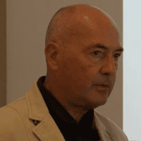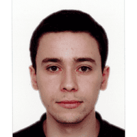
Alessandro Sebastianelli
Alessandro Sebastianelli received the degree (cum laude) in electronic engineering for automation and telecommunications from the University of Sannio where he also pursed the Ph.D. degree in Information Technologies for Engineering. His field of expertise covers remote sensing and satellite data analysis, artificial intelligence for earth observation and quantum computing. He coauthored a book and several articles to reputed journals and conferences for the sector of remote sensing. He received an IEEE award for one the best the thesis in geoscience and remote sensing. He has been firstly a visiting researcher and later a research fellow at ESA $\Phi$-lab. He has won an ESA OSIP proposal in August 2020. He is leading the working group on quantum computing for EO in the QUEST IEEE GRSSS technical committee.

Behnood Rasti
Behnood Rasti received his B.Sc. and M.Sc. degrees in electronics and electrical engineering from the Department of Electrical Engineering, University of Guilan, Rasht, Iran, in 2006 and 2009, respectively. He earned his Ph.D. in electrical and computer engineering from the University of Iceland, Reykjavik, Iceland, in 2014. He was the valedictorian of his M.Sc. class in 2009. From 2015 to 2016, he worked as a Postdoctoral Researcher at the Department of Electrical and Computer Engineering, University of Iceland. Between 2016 and 2019, he was a Lecturer at the Center of Engineering Technology and Applied Sciences, University of Iceland. Dr. Rasti was a Humboldt Research Fellow from 2020 to 2021. From 2022 to 2023, he served as a Principal Research Associate at Helmholtz-Zentrum Dresden-Rossendorf (HZDR), Dresden, Germany. He is currently a Senior Research Scientist at the Faculty of Electrical Engineering and Computer Science, Technische Universität Berlin, and the Berlin Institute for the Foundations of Learning and Data, Berlin, Germany. His research interests include signal and image processing, machine learning, deep learning, remote sensing, and Earth observation. Dr. Rasti was awarded the Doctoral Grant of the University of Iceland Research Fund (“The Eimskip University Fund”) in 2013 and the Alexander von Humboldt Research Fellowship in 2019. He serves as an Associate Editor for IEEE Geoscience and Remote Sensing Letters (GRSL).

Prof. Dr. Luis Gómez-Chova
Prof. Luis Gómez-Chova is a Full Professor at the Department of Electronics Engineering, University of Valencia, Spain, and a researcher with the Image and Signal Processing Group (ISP, isp.uv.es) at the Imaging Processing Laboratory (IPL). His research focuses on machine learning and image processing, particularly in the application domains of remote sensing data analysis and multispectral image processing. He conducts and supervises research on these topics within the framework of many international projects and he is the author of more than 75 international journal papers. Visit www.uv.es/chovago for more information.

Mihai Datcu
Mihai Datcu received the M.S. and Ph.D. degrees in electronics and telecommunications from the University Politehnica of Bucharest (UPB), Bucharest, Romania, in 1978 and 1986, respectively, and the Habilitation a Diriger des Recherches degree in computer science from University Louis Pasteur, Strasbourg, France, in 1999.
Since 1981, he has been with the Department of Applied Electronics and Information Engineering, Faculty of Electronics, Telecommunications and Information Technology, UPB. From 1992 to 2002, he had an Invited Professor Assignment with the Institute of Communication Technology, Swiss Federal Institute of Technology (ETH Zürich), Zürich, Switzerland. From 1993 to 2023, he was with the German Aerospace Center (DLR), We.ling, Germany, as a Senior Scientist with the Remote Sensing Technology Institute (IMF) and a Team Leader of the Big Data and AI for Earth Observation. Since 2001, he has been initiating and leading the Competence Center on Information Extraction and Image Understanding for Earth Observation, ParisTech, Paris Institute of Technology, Paris, France, a collaboration of DLR with the French Space Agency (CNES), Paris. From 2005 to 2013, he was a Professor holder of the DLR-CNES Chair, Paris-Tech, Paris Institute of Technology. From 2011 to 2018, he led the Immersive Visual Information Mining Research Laboratory, Munich Aerospace Faculty, Munich, Germany. From 2018 to 2020, he was the holder of the Blaise Pascal International Chair of Excellence, Conservatoire National des Arts et Métiers (CNAM), Paris. He was a Visiting Professor with the University of Oviedo, Oviedo, Spain; University Louis Pasteur and International Space University, Strasbourg; the University of Siegen, Siegen, Germany; University of Innsbruck, Innsbruck, Austria; the University of Alcalá, Alcal´s de Henares, Spain; the University of Tor Vergata, Rome, Italy; Universidad Pontificia de Salamanca, Madrid, Spain; University of Camerino, Camerino, Italy; the University of Trento, Trento, Italy; the Chinese Academy of Sciences, Shenyang, China; Universidade Estadual de Campinas (UNICAMP), Campinas, Brazil; Wuhan University, Wuhan, China; and the Swiss Center for Scientific Computing, Manno, Switzerland. He is currently a Full Professor and the Director of the Research Center for Spatial Information (CEOSapceTech), UPB. He is also a Visiting Professor with the ESA’s 8-Lab. His research interests include information theory, signal processing, explainable and physics-aware artificial intelligence, computational imaging, and quantum machine learning with applications in EO.
Dr. Datcu is a member of the ESA Working Group Big Data from Space. He was a recipient of the Romanian Academy Prize Traian Vuia for the Development of the SAADI Image Analysis System and his activity in image processing in 1987, the Best Paper Award, the IEEE Geoscience and Remote Sensing Society Prize in 2006, the National Order of Merit with the rank of Knight, for outstanding international research results, awarded by the President of Romania in 2008, Chaire d’Excellence Internationale Blaise Pascal 2017 for international recognition in the field of data science in EO, and the 2018 Ad Astra Award for Excellence in Science. He has served as a Co.-organizer for international conferences and workshops. He has served as the Guest editor and an Associate Editor for IEEE and other journals. In 2022, he received the IEEE GRSS David Landgrebe Award in recognition of outstanding contributions to Earth observation analysis using innovative concepts for big data analysis, image mining, machine learning, smart sensors, and quantum resources. He is an IEEE Fellow.

Nassim Ait Ali Braham
Nassim Ait Ali Braham received his M.Sc. degree in computer science from Ecole nationale Supérieure d’Informatique (ESI), Algiers, Algeria, in 2019 and a M.Sc. degree in Artificial Intelligence and Data Science from Université Paris Dauphine-PSL, Paris, France, in 2020. He is pursuing a Ph.D. degree at the German Aerospace Center, Wessling, Germany, and at the Technical University of Munich, Munich, Germany. In 2019, he spent six months as a research intern at the LIRIS-CNRS laboratory, Lyon, France. In 2020, he spent six months at the LAMSADE-CNRS laboratory, PSL Research University, Paris, France. In 2023, he spent six months as a visiting researcher at INRIA THOTH, Grenoble, France. His research interests include deep learning, computer vision, self-supervised learning, and remote sensing.

Silvia Liberata Ullo
Silvia Liberata Ullo, IEEE Senior Member, President of IEEE AES Italy Chapter, Europe Liaison for IEEE GRSS, Industry Liaison for IEEE Joint ComSoc/VTS Italy Chapter, National Referent for FIDAPA BPW Italy Science and Technology Task Force (2019-2021). Member of the Image Analysis and Data Fusion Technical Committee (IADF TC) of the IEEE Geoscience and Remote Sensing Society (GRSS). Visiting Professor at ESA Phi-Lab. Editor in Chief for IET Image Processing. Graduated with laude in 1989 in Electronic Engineering at the University of Naples (Italy), pursued the M.Sc. in Management at MIT (Massachusetts Institute of Technology), USA, in 1992. Researcher since 2004 at the University of Sannio, Benevento (Italy). Member of Academic Senate and PhD Professors’ Board. Courses: Signal theory and elaboration, Probability and Signals, Telecommunication networks (Bachelor program); Earth monitoring and mission analysis Lab (Master program), Optical and radar remote sensing (Ph.D. program). Authored 90+ research papers, co-authored many book chapters and served as editor of two books. Associate Editor of relevant journals (IEEE TGRS, JSTARS, GRSL and others). Guest Editor of many special issues. Research interests: signal processing, radar systems, sensor networks, smart grids, remote sensing, satellite data analysis, machine learning and quantum ML.

Sylvain Lobry
Sylvain Lobry is an assistant professor (Maître de conférences) in Computer Science. He is with the SIP team of the LIPADE laboratory and teaches at UFR de Mathématiques et Informatique in Université Paris Cité since 2020. Before, he was a postdoctoral researcher at Wageningen University & Research in the Laboratory of Geo-information Science and Remote Sensing. He obtained is PhD in image processing from Télécom Paris in 2017. This work was done in collaboration with the French spatial agency, CNES.
His research interests are in the areas of methodological developments in machine learning, with applications in Earth Observation. This includes Visual Question Answering for environment, high-resolution optical images processing using deep learning techniques and change detection, classification, and regularization on multi-temporal series of SAR images using Markov Random Fields models. During his PhD, he was working on the SWOT mission, dedicated to the study of the world’s oceans and its terrestrial surface waters.

Lucrezia Tosato
Lucrezia Tosato is a PhD student in image processing at Université Paris Cité and the French Aerospace Laboratory (ONERA), France. She holds a Master’s degree in Computer Science from Sorbonne University and an MsEng degree from the University of Trento. Her research interests include computer vision, natural language processing, SAR imagery, data interpretability, and explainability.


