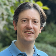
Claudio Persello
Claudio Persello is an Adjunct Professor at the Faculty of Geo-Information Science and Earth Observation (ITC) of the University of Twente. Claudio Persello received the Laurea (BSc) and Laurea Specialistica (MSc) degrees in telecommunications engineering and the PhD degree in communication and information technologies from the University of Trento, Trento, Italy, in 2003, 2005, and 2010, respectively.
Before joining ITC in 2014, he was a Marie Curie research fellow, conducting research activity at the Max Planck Institute for Intelligent Systems and the Remote Sensing Laboratory of the University of Trento. His main research interests are in the context of machine learning and deep learning for information extraction from remotely sensed images and geospatial data. The activity includes investigating and developing dedicated deep learning techniques for various remote sensing sensor data and multiple applications, focusing on societal and environmental challenges. He is particularly interested in combining deep learning and Earth observation to address and monitor the progress towards the sustainable development goals.
Dr. Persello is a referee for multiple journals and a program committee member of several conferences in the field of remote sensing and image analysis. He is an Associate Editor of the IEEE Transactions on Geoscience and Remote Sensing and a member of the editorial board of the ISPRS Journal of Photogrammetry and Remote Sensing and MDPI Remote Sensing. He served as publication co-chair for IGARSS 2021. He is the Chair of the Image Analysis and Data Fusion (IADF) GRSS technical committee. His PhD thesis was awarded the prize for the best PhD thesis on Pattern Recognition published between 2010 and 2012 by the GIRPR, i.e., the Italian branch of the International Association for Pattern Recognition (IAPR). He is a Senior Member of the IEEE.
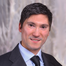
Fabio Pacifici
Fabio Pacifici has 20 years of experience in developing geospatial products, with the vision of bringing together the advancements in the satellite industry with the computer vision and artificial intelligence research communities. He is a very communicative individual, passionate about getting stuff done, and helping others through coaching and mentoring. He is interested in all aspects of remote sensing, including geospatial artificial intelligence, spaceborne image processing, superresolution, data fusion, hyperspectral and synthetic aperture radar data analysis. He has hands-on experience in calibration and validation of optical sensors, atmospheric compensation of satellite images, and radiative transfer modeling. He has authored (or coauthored) more than 100 publications including patents, book chapters, journal papers, and peer-reviewed conference proceedings. He was awarded the Seeing A Better World Award from Maxar Technologies in 2019, and the Do It Right Award from DigitalGlobe in 2017. He is the recipient of various international recognitions including the Early Career Award from the IEEE Geoscience and Remote Sensing Society (GRSS) in 2015, the WHISPERS Best Paper Award in 2014, the Best Reviewer Award from IEEE GRSS in 2011, and the Best Student Paper Award at the 2009 IEEE GRSS Joint Urban Remote Sensing Event. He also won the 2007, 2008 and 2009–2010 IEEE GRSS Data Fusion Contest. His volunteer experience with IEEE includes serving as VP of Technical Activities for the Geoscience and Remote Sensing Society and as Associate Editor for the Journal of Selected Topics in Applied Earth Observations and Remote Sensing. He was the IEEE GRSS Director of Corporate Relations (2018-2020), the Editor-in-Chief of the IEEE GRSS eNewsletter (2014-2017), and Chair of the IEEE GRSS Data Fusion Technical Committee (2011-2013).
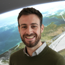
Francescopaolo Sica
Francescopaolo Sica is the Deputy Head of the Chair of Earth Observation at the Faculty of Aerospace Engineering at the University of the Bundeswehr in Munich, Germany. With a distinguished career spanning from 2016 to 2022 as a postdoctoral researcher at the German Aerospace Center (DLR) and the European Space Agency (ESA), Dr. Sica brings a wealth of expertise to his current role. His research efforts have encompassed a wide range of activities centered on Synthetic Aperture Radar (SAR) technology, from mission design to advanced SAR signal and image processing techniques to the practical deployment of SAR applications. Dr. Sica is currently pursuing his habilitation in signal and image processing, specializing in harnessing the power of deep learning methods to enhance SAR data processing and analysis.
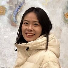
Zhaoyue Wu
Ms. Zhaoyue Wu (Graduate Student Member, IEEE) received the B.E. degree in Geodesy and Geomatics Engineering and the M.E. degree in Photogrammetry and Remote Sensing from the School of Earth Sciences and Engineering, Hohai University (HHU), Nanjing, China, in 2018 and 2021, respectively. For her outstanding academic performance, she was the recipient of the Outstanding Master Graduate of Jiangsu Province in 2021 and also obtained the awards of Outstanding Bachelor’s and Master’s Graduate of HHU in 2014 and 2021, respectively. With the support of China Scholarship Council, she is currently pursuing the Ph.D. degree in Aerospace Engineering from the University of Extremadura, Cáceres, Spain and she is also a member of Hyperspectral Computing Laboratory (HyperComp). Her research interests include remote sensing image analysis and applications, developing novel target detection methods based on advanced machine learning and deep learning algorithms. She actively contributes to the scientific field through her publications in high-impact remote sensing journals, and serving as a reviewer of IEEE Transactions on Geoscience and Remote Sensing and IEEE Geoscience and Remote Sensing letters, among others.

Mercedes Eugenia Paoletti
Mercedes Eugenia Paoletti obtained the B.Sc. and the M.Sc. in Computing engineering in 2014 and 2016, respectively, at the University of Extremadura (UEx), being recipient of the Distinguished Student recognition of the Polytechnic School of Cáceres in 2014 and 2016, and receiving the awards for the best undergraduate and master’s degree scores of the UEx (2015 and 2017) and of the Colegio Profesional de Ingenieros Informáticos de Extremadura -CPIIEx- (2015 and 2017). She also obtained the Master in Secondary Education Teaching Training and the Master in TIC management in 2018 and 2022. Finally, with support from the FPU state grant, she obtained the PhD in Information Technology in 2020, for which she received international distinction, cum laude, and Outstanding PhD Award in 2021 of the UEx. She is an Associate Professor in the dept. of Computer and Communication Technology at the University Center of Merida, UEx, and a researcher at the Hyperspectral Computing Laboratory (HyperComp). Her research focuses on the efficient processing of remote sensed hyperspectral images through the development of deep learning techniques combined with graphical processing. She has supervised 11 BSc. and MSc. thesis projects and is currently supervising 2 doctoral theses.
Regarding her research, Dr. Paoletti has carried out several research stays in national centers, such as the Universitat Jaume I of Castellón, and international centers, such as the Università Tor Vergata (Italy).
She has participated in 5 research projects, 1 international (2023), 1 national (2020) and 3 regional (2018 and 2021), all of them related to remote sensing (RS) data processing, hyperspectral imaging (HSI) analysis and improvement of high-performance computing (HPC) techniques.
Dr. Paoletti is author and co-author of 117 scientific publications, including 67 contributions to JCR journals, including 44 Q1s, 21 Q2s, 1 Q4 and 1 without index, 49 contributions to congresses, both national (16) and international (33) of relevance such as IEEE IGARSS, IEEE WHISPERS, or IEEE CBMS, and 1 book chapter. Her JCR contributions stand out in the fields of computation (e.g., Journal of Supercomputing), neural networks (e.g., IEEE TNNLS and Neurocomputing), and remote sensing (e.g., IEEE TGRS, IEEE GRSL, or IEEE GRSM), having 8 highly cited articles with 2 research fronts (InCites Essential Science Indicators of Clarivate). She is currently within the 2% percentile of the top 100,000 most cited scientists according to Ioannidis, John P.A. (2023), “October 2023 data-update for Updated science-wide author databases of standardized citation indicators”, Elsevier Data Repository, V6. She has over 4718 citations and an H index 31 (Google Scholar, March 2024).
Dr. Paoletti has also received the award for the best paper of 2019 during the international conference IEEE Workshop on Hyperspectral Image and Signal Processing: Evolution in Remote Sensing (WHISPERS) and the best paper of 2020 at the Workshop: Hyperspectral Sensing meets Machine Learning and Pattern Analysis (HyperMLPA). Furthermore, she has served as chair of the IEEE Geoscience and Remote Sensing Society (GRSS)- Spanish Chapter (2021-2023), Associate Editor of IEEE TGRS (2021-2023), and guest editor in 4 special issues in remote sensing journals. She serves as a reviewer in more than 45 high impact journals, such as Pattern Recognition, ISPRS Journal of Photogrammetry and Remote Sensing, IEEE TGRS, and IEEE GRSL. Indeed, she has been recipient of the Best Reviewer Award of IEEE GRSL in 2019 and 2020 and the Best Reviewer Award of the IEEE TGRS in 2020. She served as organizer of the 1st and 2nd webseminars of Best PhD and M.Sc. thesis award 2022 and 2023 of the IEEE GRSS- Spanish Chapter, chair of the IEEE IGARSS 2019 and 2022, member of the organizing committee of the Jornadas SARTECO 2019 and chair of the Jornadas SARTECO 2019.
Dr. Paoletti has received several awards for her research activity. She is a senior member of the IEEE, has received the Outstanding Research Career Award of the UEx in 2023 and the Research Award of the Scientific Computer Society of Spain (SCIE) – BBVA Foundation, in 2022.

Michael Schmitt
Michael Schmitt received his Dipl.-Ing. (Univ.) degree in geodesy and geoinformation, his Dr.-Ing. degree in remote sensing, and his habilitation in data fusion from the Technical University of Munich (TUM), Germany, in 2009, 2014, and 2018, respectively. Since 2021, he has been a Full Professor for Earth Observation at the Department of Aerospace Engineering of the University of the Bundeswehr Munich (UniBw M) in Neubiberg, Germany. He is also a member of the Research Center SPACE and the Institute of Space Technology & Space Applications of UniBw M.
From 2020 to 2022, he additionally held the position of a Consulting Senior Scientist at the Remote Sensing Technology Institute of the German Aerospace Center (DLR).
Before joining UniBw M, he was a Professor for Applied Geodesy and Remote Sensing at the Munich University of Applied Sciences, Department of Geoinformatics. From 2015 to 2020, he was a Senior Researcher and Deputy Head at the Professorship for Signal Processing in Earth Observation at TUM; in 2019 he was additionally appointed as Adjunct Teaching Professor at the Department of Aerospace and Geodesy of TUM. In 2016, he was a guest scientist at the University of Massachusetts, Amherst. His research focuses on technical aspects of Earth observation, in particular image analysis and machine learning applied to the extraction of information from multi-modal remote sensing observations. He is a co-chair of the Working Group “Active Microwave Sensing” of the International Society for Photogrammetry and Remote Sensing, and an active member of the Working Group “Benchmarking” of the IEEE-GRSS Image Analysis and Data Fusion Technical Committee. He frequently serves as a reviewer for a number of renowned international journals and conferences and has received several Best Reviewer awards. He is a Senior Member of the IEEE and an Associate Editor of IEEE Geoscience and Remote Sensing Magazine as well as a Co-Editor of the Springer Journal of Photogrammetry, Remote Sensing and Geoinformation Science (PFG).

Pedram Ghamisi
Pedram Ghamisi (Senior Member) obtained his Ph.D. in electrical and computer engineering from the University of Iceland in 2015. He currently serves as (1) the head of the machine learning group at Helmholtz-Zentrum Dresden-Rossendorf (HZDR), Germany, and (2) visiting full professor at Lancaster University, UK. He has previously held positions as Senior PI, research professor, and group leader of AI4RS at the Institute of Advanced Research in Artificial Intelligence (IARAI), Austria. He has achieved more than 10 international awards and recognitions, including IEEE-GRSS Highest Impact Paper Awards for 2020 and 2024, Winner of the Data Fusion Contest 2017 organized by IEEE GRSS, IEEE Mikio Takagi Prize for 2013, and the 2017 Best Reviewer Prize of IEEE GRSS. Additionally, he was named one of the top 1% of most cited researchers, as published by Clarivate in 2021, 2022, and 2023. His research interests primarily revolve around deep learning, particularly in the domain of remote sensing applications. Prof. Dr. Ghamisi has also been the recipient of multiple scholarships and grants, such as the High Potential Program (HPP) Team Leadership in 2018 and the Alexander von Humboldt Fellowship in 2015. For more information, please visit http://www.ai4rs.com.
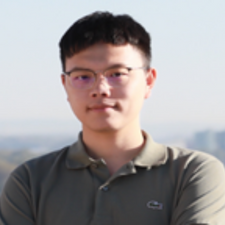
Weikang Yu
Weikang Yu received his M.Phil and B.E. degrees from the Chinese University of Hong Kong, Shenzhen, and Beihang University, respectively. He is currently a PhD researcher at the Helmholtz Institute Freiberg (HIF) for Resource Technology, Helmholtz-Zentrum Dresden-Rossendorf (HZDR), Germany. His research focuses on developing cutting edge deep learning models for remote sensing (RS) applications, as parts of the Artificial Intelligence for Remote Sensing (AI4RS) studies. In particular, he is interested in the studies of change detection, unsupervised domain adaptation (UDA), and image enhancement.

